
Finding Who Lives on a Herriman Street
A Herriman street directory search begins with the address in hand. The public trail can show an assessed owner, parcel, transfer, dated election field, or older directory entry. It cannot guarantee a list of everyone at a location. Use the address as a fixed point and record the source, date, and address type.
- Run the official address in the Salt Lake County Assessor search. Select the autocomplete result and save parcel ID, owner, situs address, tax class, value, and tax year.
- Open the same parcel in the Salt Lake County Assessor Parcel Viewer or Herriman GIS. Check adjoining polygons, subdivision, city-limit, zoning, and other map layers.
- Use the Recorder property list with the parcel or selected address. Save the latest instrument, entry number, grantor, grantee, recording date, and legal description.
- Use public voter data only through the permitted self-status or election-file route. Treat a name, address, age range, district, or status as a dated election record, not a household count.
- For earlier households, search geographic directory sections, census schedules, tax cards, permits, newspapers, and the exact historical place label.
The sequence is address, parcel, map, deed, lawful election context, then history. A common name still needs a second identifier, such as legal description, age range, spouse, or dated address.
Herriman Assessor Search Fields
The County Assessor supplies the modern address entry point. Its search uses Owner, Address, and Parcel Number. The owner field follows “Last Name, First Name,” while the legacy screen supports frontage and street fields. Select the official situs address when autocomplete offers several choices.
| Field | Type and Herriman search note | Required |
|---|---|---|
| Owner | Text, Last Name, First Name; legacy search asks for at least three letters | Optional |
| Address | Autocomplete; choose the official situs or property address | Optional |
| Parcel Number | Text, 00-00-000-000-0000; first seven digits can retrieve a block | Optional |
| Frontage Number | Text house or frontage number on the legacy screen | Optional |
| Direction | Text or dropdown for N, S, E, or W | Optional |
| Street and type | Street name or number plus street type or direction | Optional |
The legacy result can be sorted and opened in classic or printable view. The first seven parcel digits are an index convenience for an area, section, or block. They do not define a legal block or count households. Remove roads, open space, outside parcels, and another tax district before treating results as a block sample.
The legacy Salt Lake County Assessor search shows the frontage, direction, street, owner, and parcel-prefix controls used in the street directory workflow.
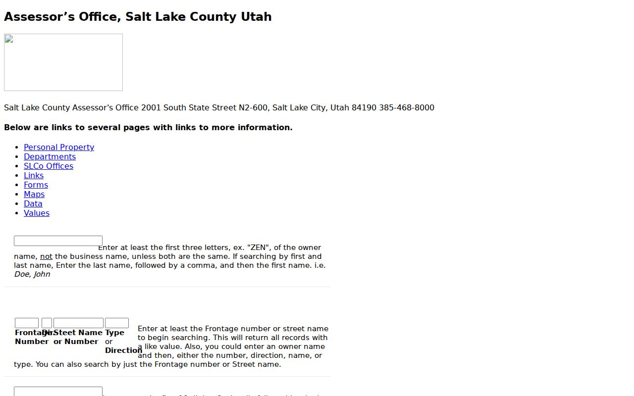
That older interface is valuable when a modern autocomplete misses an older spelling or a partial street clue. Compare the returned situs to the map before moving on.
Herriman Records Searchable by Street
Address-keyed records make a street directory more useful than a name list because they preserve the parcel or place as the common link. The coverage is uneven. Some records are live and free, some are paid or office-mediated, and some are historical collections with gaps.
| Record set | Keeper | Street-level evidence | Access |
|---|---|---|---|
| Property and tax roll | Salt Lake County Assessor | Owner, situs, mailing clue, value, exemption, parcel detail | Free online and counter |
| Parcel map and layers | County Assessor and Herriman GIS | Adjacent parcels, zoning, subdivisions, districts, flood, city limits | Free viewers and services |
| Deeds, liens, and plats | Salt Lake County Recorder | Transfers, grantors, grantees, legal descriptions, entry and image references | Free list, paid data and images |
| Voter file | County Elections and Utah | Permitted name, physical or mailing address, age range, districts, status | Self-status or lawful request |
| Tax and permit cards | Salt Lake County Archives | Address, owner history, building details, work dates, original-owner filing | Online, appointment, or staff research |
| Historic directories and census | Marriott, NARA, FamilySearch, Archives | Past names, addresses, households, and changing place labels | Online, microfilm, or collection access |
Parcel ID ties the Assessor record to the Recorder trail. A legal description can bridge a street alias, a subdivision change, or a rural label that does not match the modern address. A permit card may be filed by original owner surname and year, while a tax card needs an address. Those filing choices explain why one search field may work while another does not.
Herriman Parcel Viewer Layers
Parcel Viewer changes a one-address query into a street and block check. Search the address, click its parcel polygon, open the owner popup, use Pan to Selected, and click adjoining polygons. Distance in Feet, Buffer, and Draw tools can define a radius or street segment.
Herriman GIS adds zoning, subdivisions, council districts, floodplains, parks, trails, the cemetery, street atlas, snowplow, and coverage layers. Public ArcGIS services include HOA, subdivision, parcel, new-development, road-centerline, parcel-centroid, and city-limit layers. These explain geography, not membership names.
Switch between street, aerial, topo, and historical imagery when a road shift, vacant parcel, new subdivision, or older building footprint could affect the address match. The map can show that two records refer to adjoining land, but the Recorder legal description remains the stronger link for a transfer.
The Herriman GIS map page is the local source for street atlas, subdivision, district, flood, cemetery, and related geography.
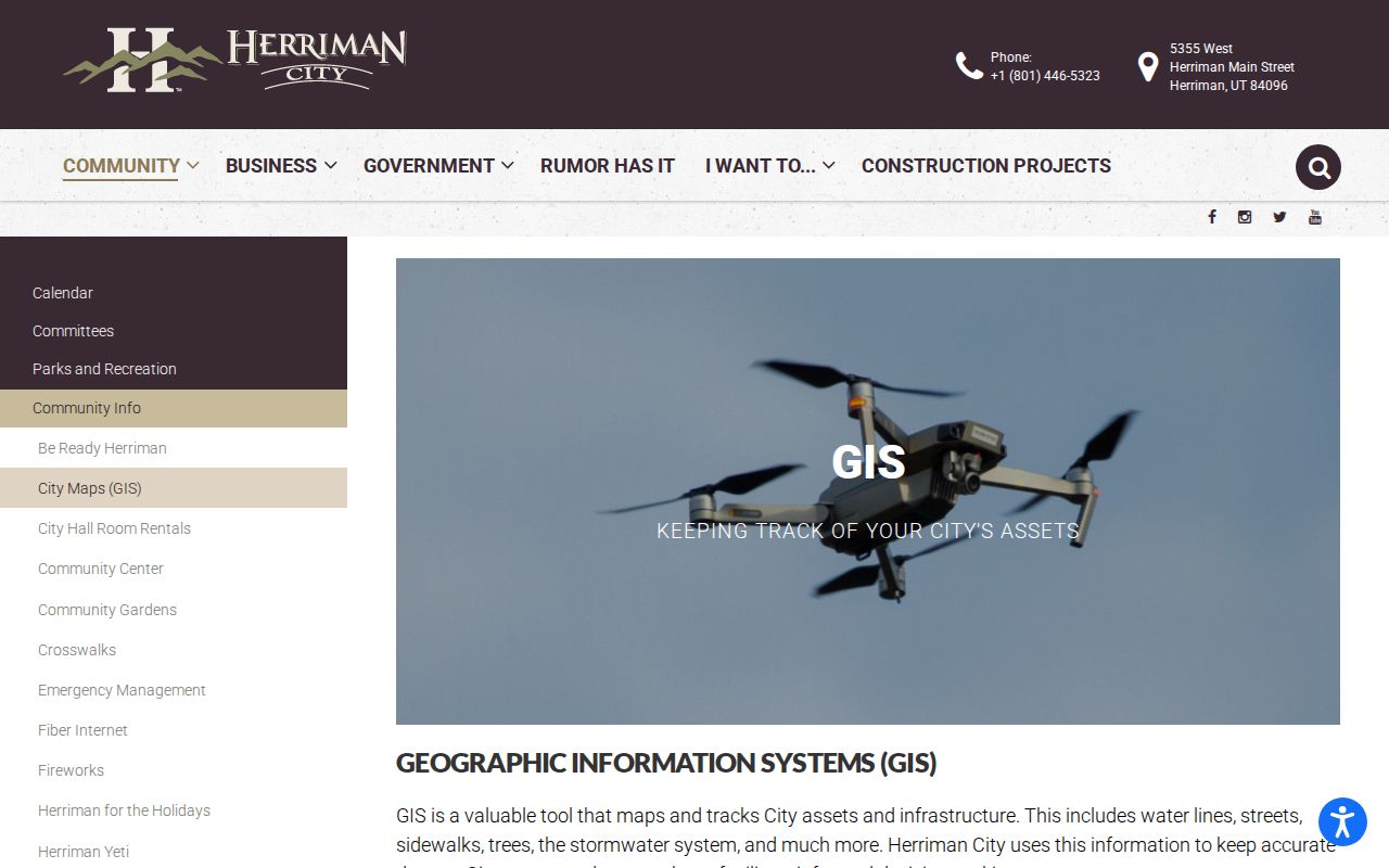
Use the map to define the search area, then return to the parcel and document systems for names and dates. A map layer is context, not a people index.
Herriman Street Labels Change Over Time
Modern street searching can fail when the historic record uses another place label. Herriman grew from Butterfield and Fort Herriman roots into a rural farming, ranching, mining, and smelter area. The city incorporated in 1999; Rosecrest was annexed in 2009, and Olympia became effective January 1, 2022.
Search Herriman, Butterfield, Riverton, rural county, subdivision, and nearby terms in directories, census, deeds, and newspapers. ZIP 84096 was created July 1, 2006 from part of former Riverton 84065 deliveries. Postal identity, city limits, tax, school, water, fire, and HOA boundaries differ.
Save both the literal historical wording and the modern parcel match. That gives a later reader a reason for an apparent mismatch instead of making an unsupported correction.
Herriman Deed Chain by Address
The Recorder answers how an interest changed, not who lived in each year. Start with the current Assessor owner and parcel. Query the Recorder's free property list by selected address or parcel, open the latest transfer, and copy the grantor, grantee, legal description, instrument date, recording date, entry number, book or page, document reference, and consideration if shown.
- Read the latest legal description and confirm that lot, block, subdivision, or other wording matches the Assessor parcel.
- Search the latest grantor as an earlier grantee and search both party roles because indexing can place a person in more than one role.
- Repeat until the description changes, the record reaches an older book, or the online index stops.
- If the address is absent, try the subdivision plat, lot and block, parcel history, tract index, prior spelling, and legal description.
The County Recorder cautions that public data may be at least 24 hours old and that a title search may be needed. A free list is not a certified chain of title. Paid Data Services can add images, plats, and chain tools, but the record date and legal description should remain with each result.
Herriman Tax Cards and Permits
Salt Lake County Archives keeps a house-history layer that is more specific than a broad name search. Tax appraisal cards cover 1934–1987, with 1970s–1991 digitization noted. Building-permit cards cover 1948–1969, and permits run approximately 1970–2019. Older cards may be filed by original-owner surname and year, while permits are address-accessible.
Tax cards can show ownership, street number, building class, stories, additions, rooms, depreciation, garage, appraisal date, and footprint. Permit material can carry project, inspection, occupancy, utility, architect, contractor, cost, or legal details when present in the record. A missing online card may still be physical. Appraisal digitization was approximately 73 percent complete as of August 2024.
County Archives also preserves incomplete aerial sets from 1946, 1952, 1958, 1964, and 1979. Request a narrow address and year range, ask for the record series before booking, and distinguish a catalog reference from a scanned image.
Herriman Property Watch Address Quirks
Property Watch is a free recorded-document alert service tied to a selected physical property address. The alert can show parcel number, recorded entry number, document type, and recorded date. The page warns that the physical address on the property can differ from the tax mailing address, so a search should use the property selection rather than a mailing clue.
The first ten autocomplete addresses may be all that appears until more characters are typed. Some duplexes work better with a number range. Property Watch does not catch every document, especially an instrument not attached to a property, and it does not decide clear title. Treat an alert as a lead back to the Recorder, not as proof of a new household or current owner.
The Salt Lake County Property Watch instructions preserve the physical-versus-mailing address distinction that matters in a street directory.
Voters Along a Herriman Street
A voter file can add a dated registration presence to a street question, but it has strict limits. Public fields may include name, physical and mailing address, age range, county, precinct, districts, party or unaffiliated status, active or inactive status, last update date, and vote history. Full date of birth, ID numbers, phone, email, signature, and At-Risk identities are withheld.
The self-status tool is for an individual checking registration and polling information. A statewide request is different, and a Salt Lake County list comes from County Clerk Elections. The inspected notice listed a $1,050 one-time tab-delimited file, about 150 MB, with download within one business day. Who-voted and absentee reports were listed at $35 per election in the stated even-year window. Confirm current terms.
Use election data only through the permitted route. An inactive record does not prove a move, and a withheld or missing record must not be reconstructed from other sources. A voter result can support district or participation context, but it should never be presented as a full street roster.
The Vote.Utah.gov registration and status route is the proper individual starting point when a voter question is about the person’s own record.
Historical Address-to-Occupant Records
Printed directories provide a historical address-to-person layer, but no official Herriman reverse or criss-cross run was verified. The University of Utah Marriott Library collection has geographic and alphabetical arrangements, scattered Utah years, and a digitized 1919 sample. An entry may contain name, spouse or widow notation, occupation, address, room, and b or r marks.
Search the geographic section by address, verify the number against a historic map, then use the alphabetical entry. OCR can split surnames or numbers, so use the image and record page and volume year. Pair directory years with census schedules from 1850 through 1950, allowing for township, precinct, or county geography.
The Herriman city directory collections page owns the detailed historical-shelf method. The street directory role here is narrower: use the collection to test a past address after the modern parcel and legal description have been identified.
- Parcel
- A county property unit with an ID, legal description, and mapped boundaries.
- Situs address
- The physical property location used to connect a parcel to a street.
- Plat
- A recorded map that lays out lots, blocks, streets, or subdivision boundaries.
- Criss-cross directory
- An address-organized directory that can lead from a street number to an occupant entry.
Herriman Street Boundaries and ZIPs
A street can cross boundaries. Herriman GIS supplies city, subdivision, zoning, flood, council, cemetery, and street-atlas layers. County parcel and tax data may use another district. ZIP 84096 is a delivery identity, not a city-limit line, and former 84065 can remain in an older trail. School, water, fire, and HOA boundaries differ.
When a search spans a boundary, keep the street name, city label, ZIP, parcel, tax district, and legal description in separate fields. That makes it possible to explain why a current map, a deed, and a historic directory use different place names. It also prevents the first matching address from being treated as the right parcel without a map check.
What a Herriman Street Directory Cannot Show
A public street directory can show an owner of record, a parcel, a mailing clue, a dated voter field when lawfully available, a filed court address, or a historical directory entry. It cannot show every household member, private utility customer, DMV address history, a protected voter, a Safe at Home actual address, or a sealed, juvenile, adoption, or private court matter. It may also miss an owner using a different mailing address, an entity or trust, or an unmatched legal description.
Do not infer current residence from an owner, a case party, a business filing, a cemetery record, or a last known address. For an identity question, preserve two independent identifiers and use the proper custodian. If a record is withheld, accept the boundary rather than assembling fragments around it.
Lawful use. Herriman address records are for lawful personal, family-history, property, and civic research. Never use a name or street trail to stalk, harass, intimidate, or harm anyone.
A careful street directory result is a dated, source-labeled record trail. It is not a promise that every person at an address appears in public data.